Map Tatra Hohe, Belaer / Tatry, Vysoké, Belianske KW 1:25.000
Fiyatı:
29.00лв.
€14.83
-
Kod:9783991541783
-
Ağırlık:0.234 Kg
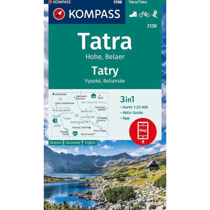
The KOMPASS map no. 2130 offers highly detailed coverage of the High Tatras (Vysoké Tatry) and the Belianske Tatras (Belianske Tatry) — the most majestic and alpine section of the Carpathian Mountains, located on the border between Slovakia and Poland.
This map is ideal for hikers, mountaineers, and outdoor enthusiasts looking for accurate and up-to-date cartographic information.
Key features:
Highly detailed scale 1:25,000 – ideal for demanding mountain hikes and alpine navigation
Shows marked hiking trails, including trail numbers and difficulty levels
Indicates elevation contours, peaks, summits, huts, lakes, ridgelines, and mountain passes
Includes national park boundaries and protected zones
Printed on durable, weather-resistant paper
GPS-compatible – ideal for modern outdoor navigation devices
Includes a comprehensive legend and touristic information (accommodations, viewpoints, cable cars, etc.).
Area covered:
Vysoké Tatry (High Tatras) – Slovakia’s most visited mountain region, featuring Gerlachovský štít, Lomnický štít, and popular resorts like Štrbské Pleso and Tatranská Lomnica
Belianske Tatry (Belianske Tatras) – a protected and wilder mountain area known for its karst landscapes and unique flora
English, German, Slovak
Kullanım Şartları
These are our terms & conditions.