Collins Europe Essential Road Atlas 2017
-
Code:9780008203580
-
Weight:0.300 Kgs
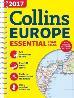
Scale of main maps 1:1,000,000 (1 cm to 10 km / 1 inch to 16 miles).
MAIN FEATURES
Clear, easy to follow road maps at a scale of 1:1,000,000. Euroroutes and motorways are easily distinguished on the mapping. The maps also show international road classifications, road distances in kilometres and relief is shown by attractive layer tints.
INCLUDES
• Route planning maps.
• Over 100 scenic routes shown.
• Toll motorways shown.
• Guide to international road signs, driving advice and useful internet links.
• Route maps of 64 major cities.
• Street plans of 16 major cities.
• Locator diagrams on each page to help you navigate.
• More detailed road maps extending from Amsterdam to Munich, making route following easier through this densely populated area.
• Top 25 European destinations as recommended on Tripadvisor®
AREA OF COVERAGE
The mapping extends from the North Cape (Norway) to Gibraltar and from Ireland to east of Moscow. Also includes Iceland and Cyprus.
Terms & Conditions
Terms of Use briefly
You can find a book that interests you browsing the categories or using the search engine.
Site registration is not mandatory.
The delivery cost to Bulgaria is fixed and does not depend on the number and weight of the books ordered - 5.90 lv for a courier delivery and 4.90 lv to Econt office. Orders over 42.00 lv are delivered for free if the order is dispatched at once. In cases where the order is over 42.00 lv and part of the books are with 30 or 60-day-delilvery term, then the free delivery is applied to the books in stock, and the rest is dispatched with the usual price - 5.90 lv for a courier delivery and 4.90 lv to Econt office. If the customer wants to have all the books dispatched together, then they should request that in the Special Instructions field.
Usual delivery time - 2-3 working days for items in stock.
- for individual orders - 20 days for English titles and 25 days for German titles.
Prolonged delivery time - rarely needed up to 20 days for delivery of books available online and up to two months for individual orders. In these cases the customer is promptly informed about the changes in the delivery time.
We accept payment by cash - paid to the courier upon receipt of the books and bank transfer.
Please contact us for further details if you wish to pay with a bank tansfer.
The amount you pay is equal to the price of the ordered goods with delivery costs. This amount represents an advance in the sense of Art. 53, par. 1 of the Law on Consumer Protection, for which you give consent by clicking the "Finalize order" button.
Returns
You may return your order within 14 days from the day of purchase, under the following conditions:
1. The book is intact, without injuries, scratches or external damage;
2. There are no torn pages;
3. There are no damages caused by the customer due to careless transportation or misuse;
4. Where there are supplies or accessories included, they are intact in their original packaging;
5. The transportation costs for the return of the order are covered by the customer.