Collins Europe Essential Road Atlas 2017
-
Код:9780008203580
-
Тегло:0.300 кг

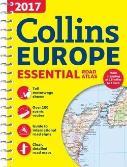
Scale of main maps 1:1,000,000 (1 cm to 10 km / 1 inch to 16 miles).
MAIN FEATURES
Clear, easy to follow road maps at a scale of 1:1,000,000. Euroroutes and motorways are easily distinguished on the mapping. The maps also show international road classifications, road distances in kilometres and relief is shown by attractive layer tints.
INCLUDES
• Route planning maps.
• Over 100 scenic routes shown.
• Toll motorways shown.
• Guide to international road signs, driving advice and useful internet links.
• Route maps of 64 major cities.
• Street plans of 16 major cities.
• Locator diagrams on each page to help you navigate.
• More detailed road maps extending from Amsterdam to Munich, making route following easier through this densely populated area.
• Top 25 European destinations as recommended on Tripadvisor®
AREA OF COVERAGE
The mapping extends from the North Cape (Norway) to Gibraltar and from Ireland to east of Moscow. Also includes Iceland and Cyprus.